
Case study natural hazards Seattle
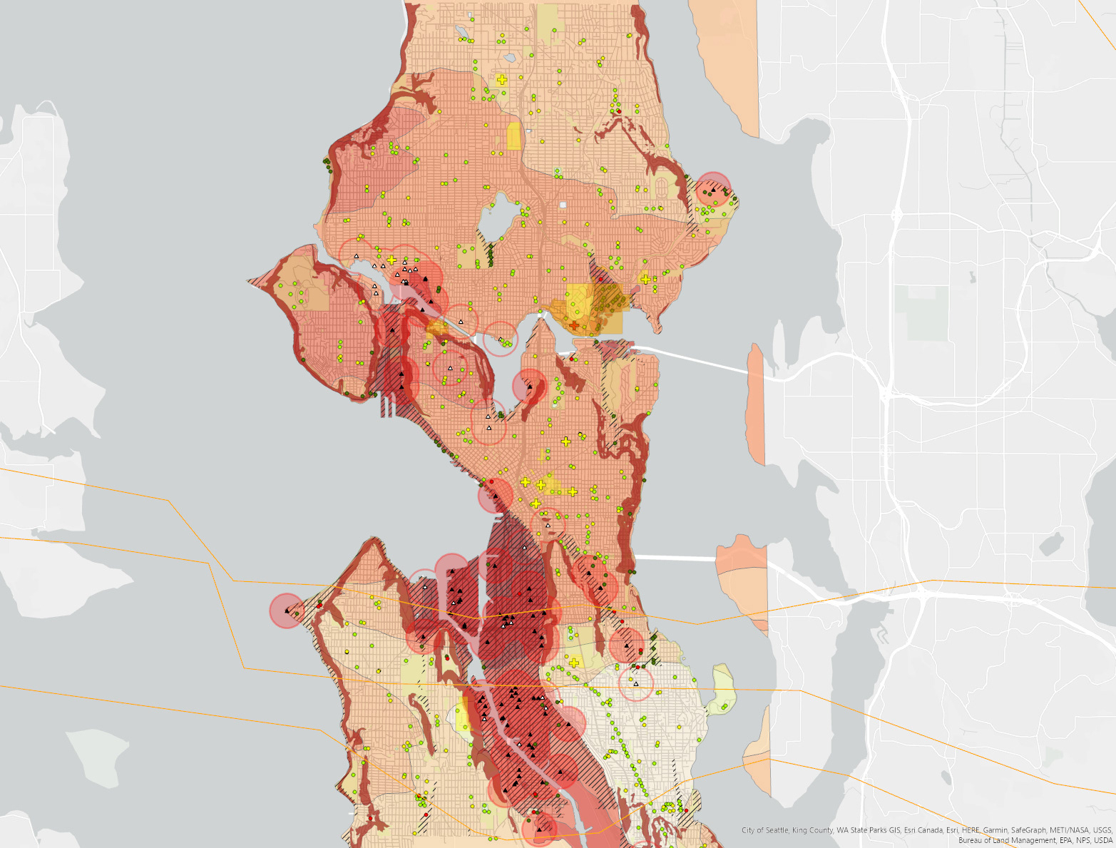
A geographic analysis of earthquake and flood threats in the city of Seattle, WA. The last map is about safe zones, with a radius of 2x 416 meters, and regards areas located above 30m from the water level.
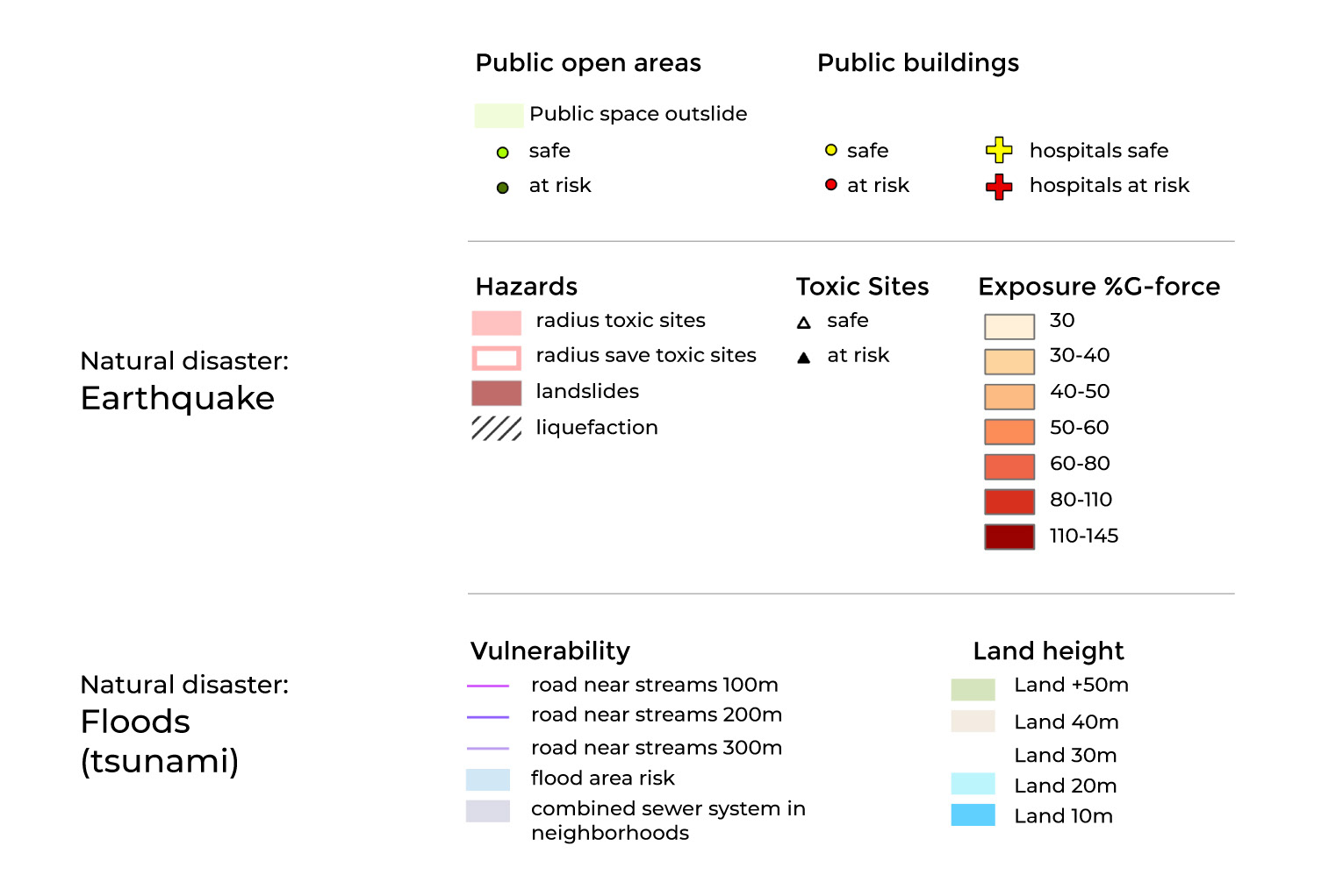
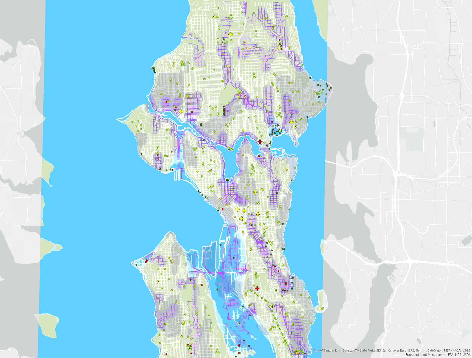
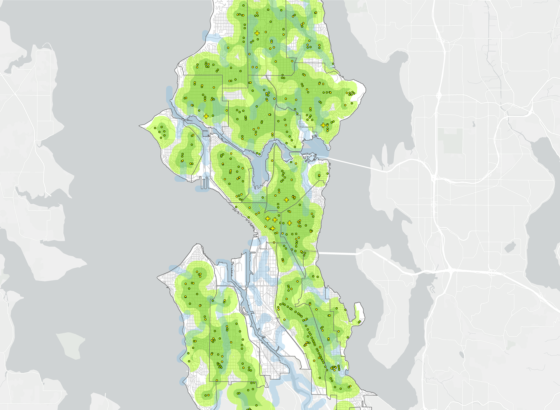
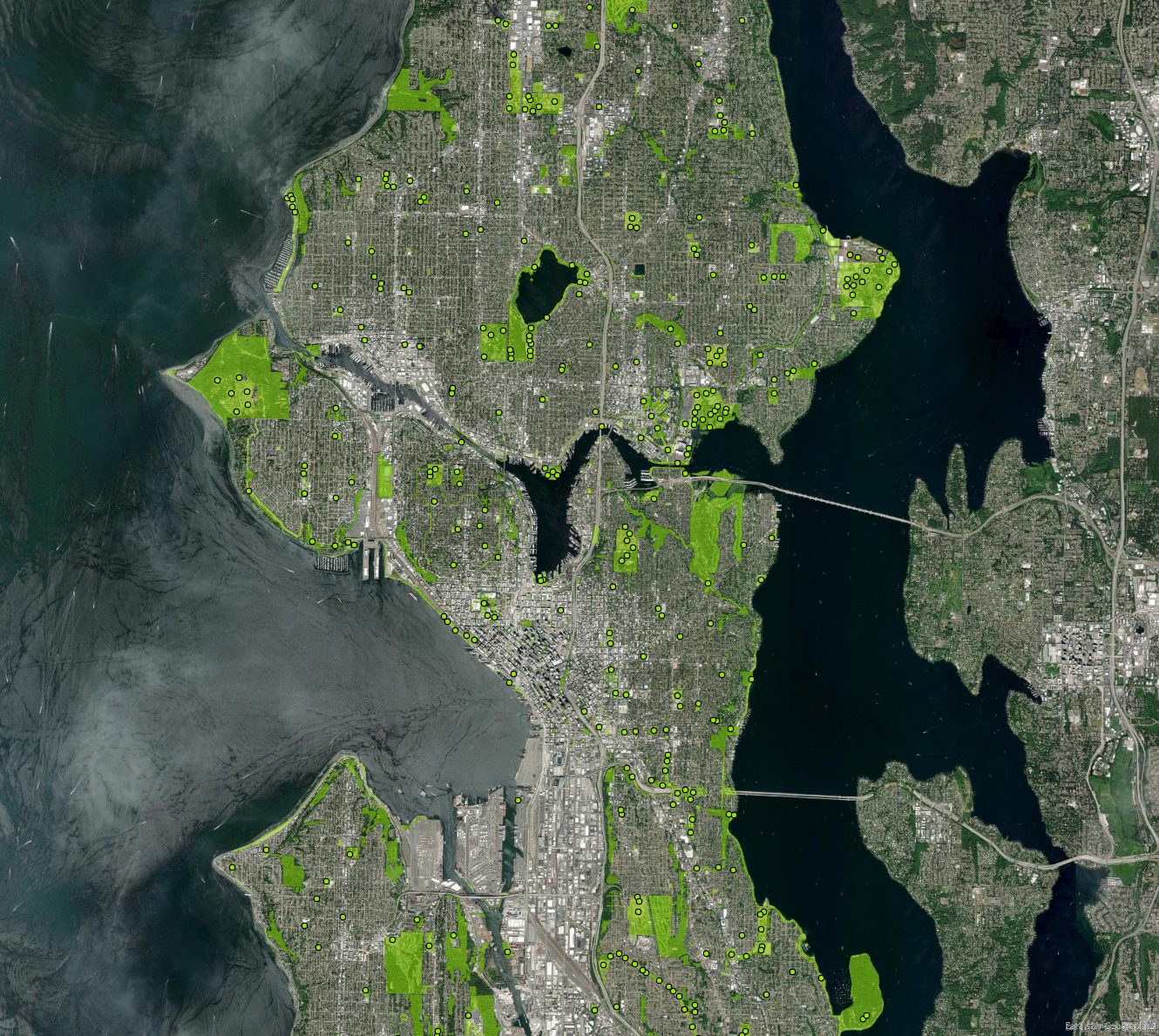
A geographic analysis of earthquake and flood threats in the city of Seattle, WA. The last map is about safe zones, with a radius of 2x 416 meters, and regards areas located above 30m from the water level.