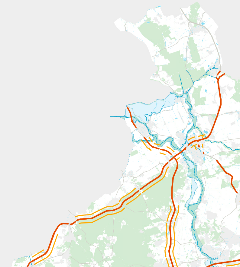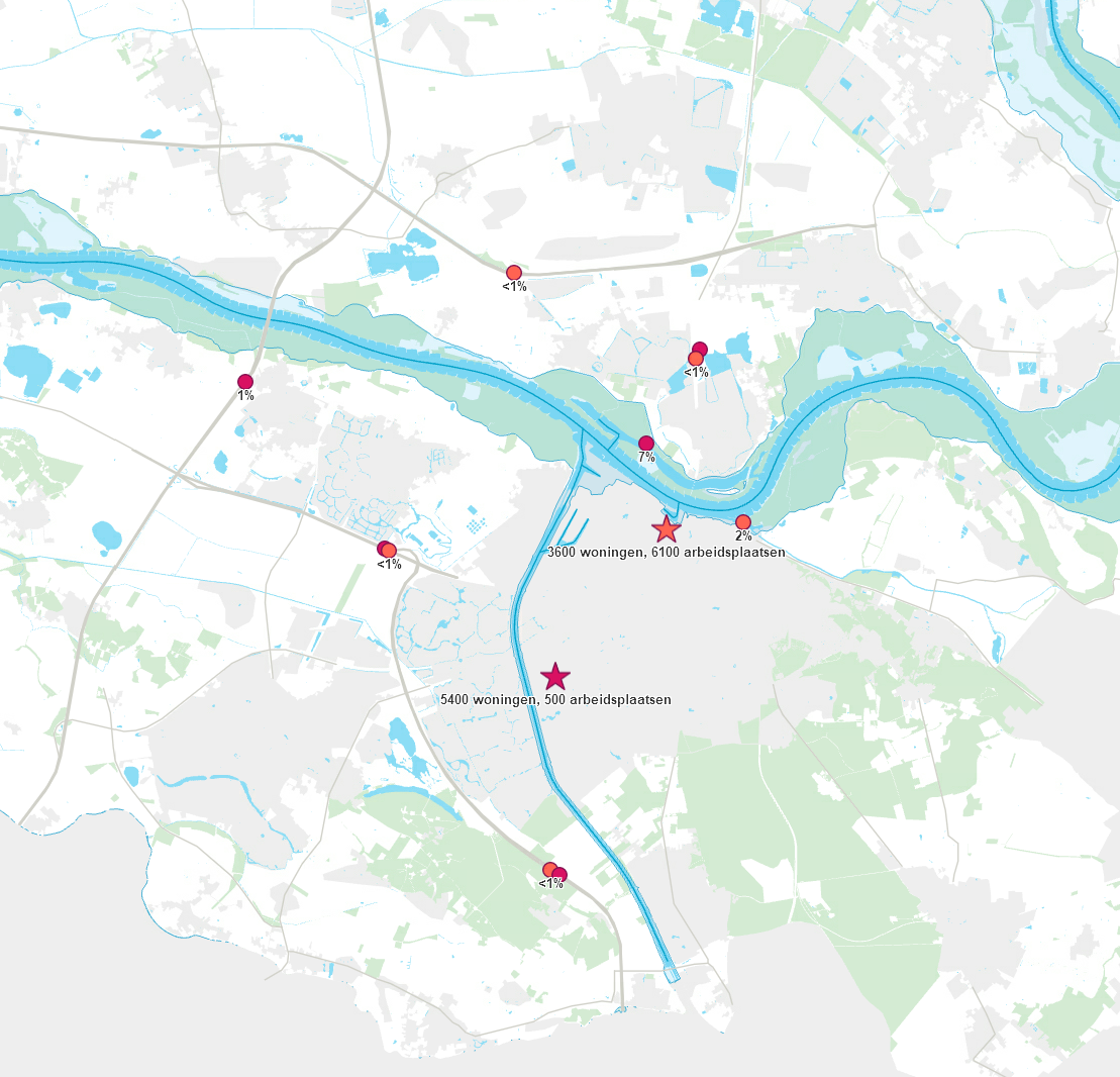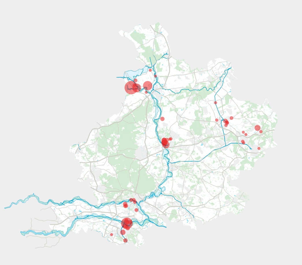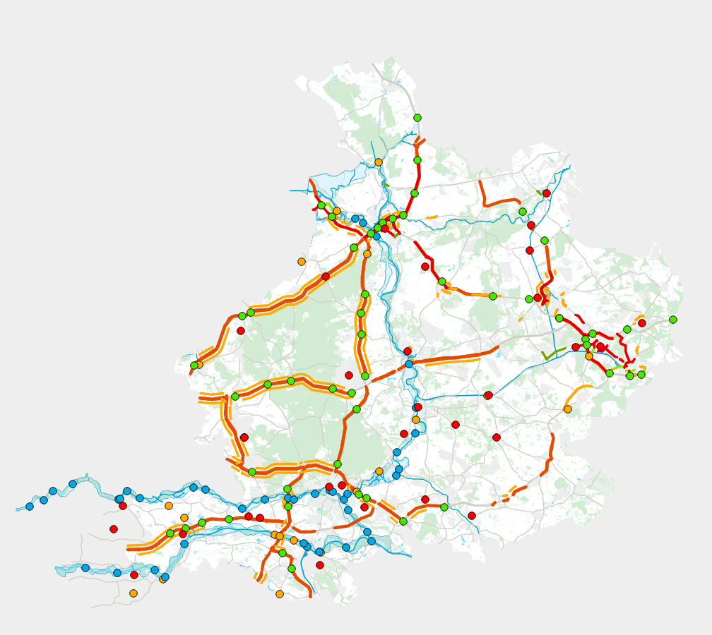

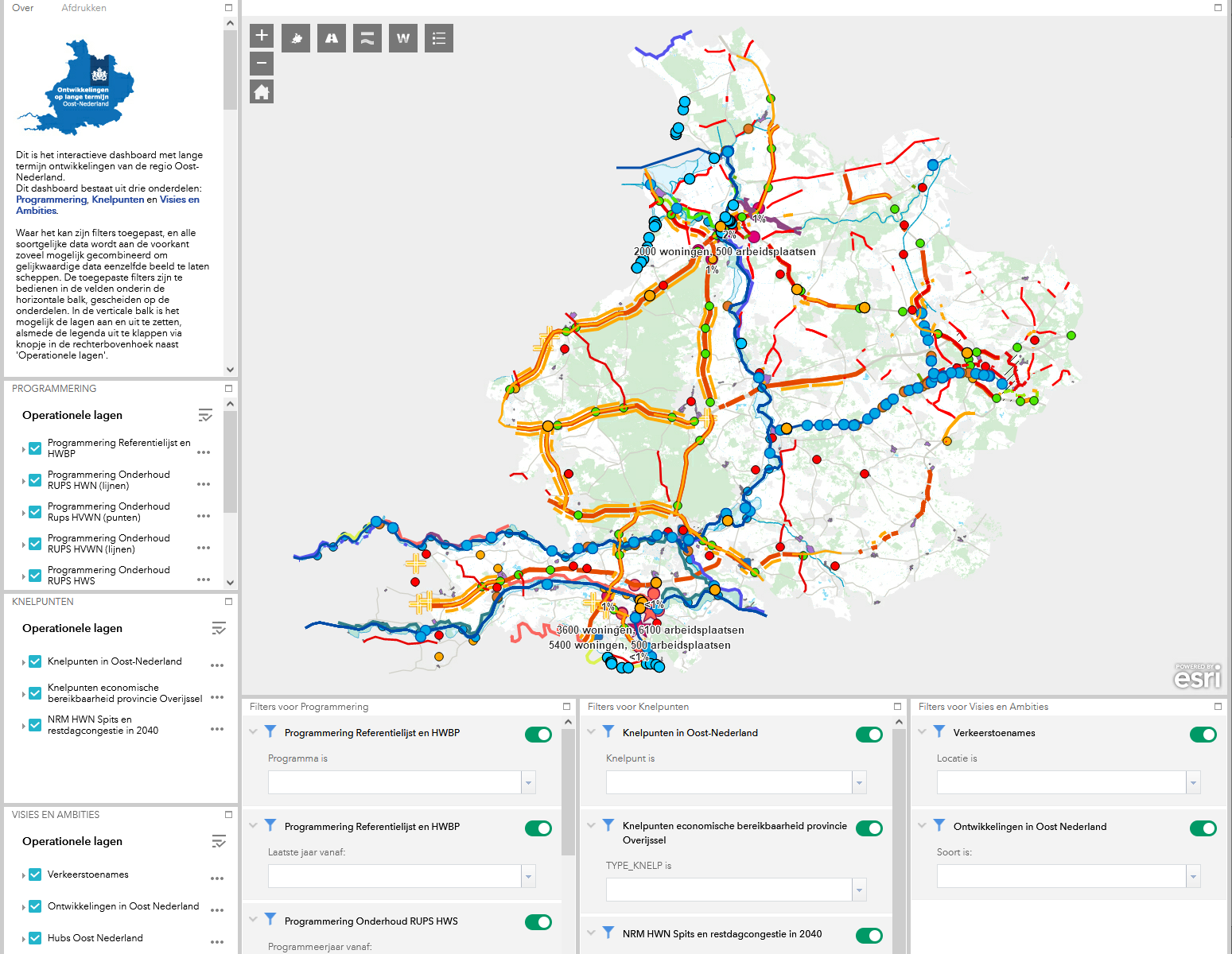
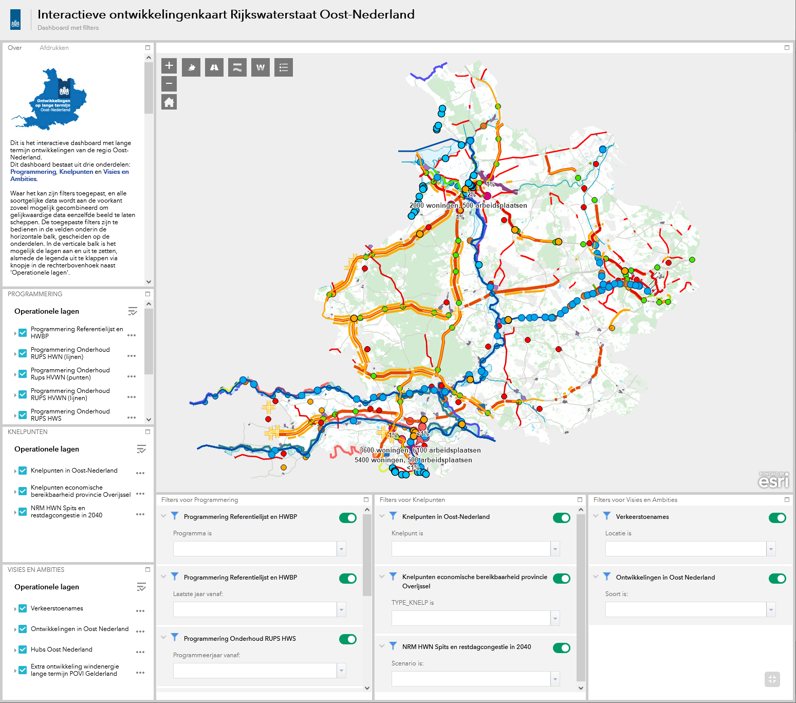
GIS dashboard regional development Rijkswaterstaat
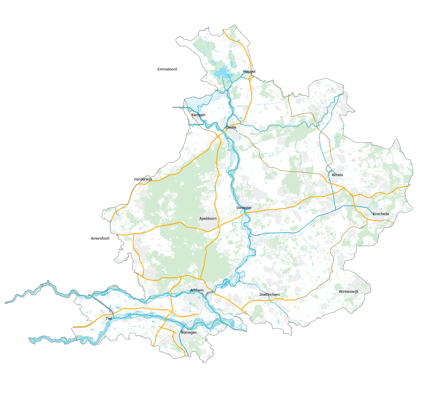
During an internship at the Directorate-General for Public Works and Water Management (Rijkswaterstaat), part of the Ministry of Infrastructure and Water Management of the Netherlands, I developed an interactive map to support strategic decision making on a regional level. Also it helps to overview both national programming as the development plans of the provinces in within the region of interest.